| Bijan Bakery
The Bijan bakery is in the Saratoga
Square plaza (Lions Supermarket). It is just off 280, a few miles
south of 85 and a few miles north of 17. This is our main meeting
place where carpool will be arranged. Unless indicated otherwise, please
meet here.
1. From 280 North or South, get off
on Saratoga Ave, towards North (from 280 North, it would be right turn,
from 280 South, it would be left turn).
2. Make a left on Kiely Blvd, it
is about 1/4 mile from 280.
3. Make a left into the plaza
driveway. You'll see a store with the sign "Bakery" closest to Kiely
Rd. Burger King is across the parking lot in the same plaze.
4. We'll meet in front of
the bakery, by some outdoor cafe tables.
Use this link to get directions from
your starting point: Directions. |
 |
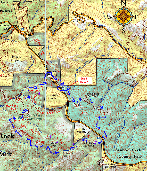
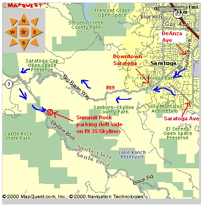
| Summit Rock parking
1. Take DeAnza or Saratoga Ave towards
downtown Saratoga.
2. Turn onto Rt 9 towards Big Basin
once you get to downtown Saratoga. You will pass through downtown Saratoga.
3. Go on Rt 9 (all uphill,
avg 35 mph) until you hit Rt35, otherwise known as Skyline Blvd.
4. Turn left on Skyline for about
2 miles. The Summit rock parking is on your left. If you pass
this, you'll see the Castle Rock entrance a few more miles down, on your
right. Turn back to find Summit Rock parking. There is space
for maybe 10 cars.
If you are meeting us here, please
wait by the trailhead.
Click on the map on the right to
zoom in/out of the area. |
 |