| Bijan Bakery
The Bijan bakery is in the Saratoga Square plaza (Lions Supermarket). It is just off 280, a few miles south of 85 and a few miles north of 17. This is our main meeting place where carpool will be arranged. Unless indicated otherwise, please meet here. 1. From 280 North or South, get off
on Saratoga Ave, towards North (from 280 North, it would be right turn,
from 280 South, it would be left turn).
Use this link to get directions from your starting point: Directions. |
 |
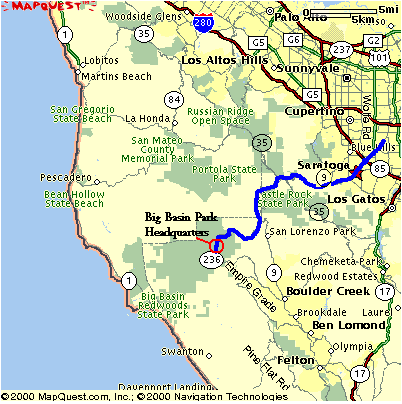
| Big Basin Redwood
State Park
1. Take DeAnza or Saratoga Ave towards
downtown Saratoga.
If you are meeting us here, please give yourself 1 hr 15 minutes to get to the park from Bijan and wait by park headquarters. If you are considering meeting us at the park, please do let me know ahead of time, thanks! Email me at pthuang@aol.com Click on the map on the right to zoom in/out of the area. Or more information: http://www.bigbasin.org/travelbasics.html |
 |